Storm Babet is forecast to hit Salford late on Wednesday night and into Thursday morning as residents brace for torrential downpours.
Some areas of higher ground could expect between 150-200mm of rain overnight with Salford specifically expecting up to a centimeter of rain per hour during the height of the storm.
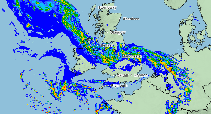
Babet will hit the UK around midday today, reaching land in Southern Ireland first before moving up the coast and eventually inland and hitting Greater Manchester at around 9pm on Wednesday and finally passing over at around 5am Thursday morning.
#StormBabet has been named by @metoffice and is forecast to bring impactful heavy rain to the UK from Wednesday this week
Strong winds will accompany the storm
Stay #WeatherAware pic.twitter.com/YJYB3haD4L
— Met Office (@metoffice) October 16, 2023
The Met Office has warned that high winds will also accompany the downpours making for a wicked combination, with areas of the North and Scotland to experience gusts of up to 60/70mph which is why the Met Office have issued a yellow weather warning for parts of the North, most of Ireland and Scotland.
With so much rainfall expected in such a short space of time on Wednesday evening the Met Office have also issued a flood risk map for UK residents to see if they are at serious risk of flooding and if so the necessary steps to take in order to prepare for and prevent flood waters.
Salford itself has measures and infrastructure in place in order to prevent flooding and minimise its effect on the community. With the renovation and repurposing of Kersal Wetlands into a floodplain just over five years ago the area is well prepared for a storm of this nature.
For live Updates on the weather in your area, disruption caused by it and advice of what to do in the event of a flood sign up for Floodline via the Met Office website or follow the Met Office Twitter.


Recent Comments